
Jump to: May(to Eastham)
Jump to: June(to Fidlers Ferry)
Jump to: June(to Hale Head)
Jump to: July(to Hempstone Point)
Jump to: July(to Hale Head)
Jump to: August(to Fidlers Ferry)
Jump to: November(to Bromborough)
Wednesday 27 May (Liverpool HW 14.57 8.4m). Sunny, warm, calm.
Enter river from marina at 1:40pm with about 9 other boats. Head over to Cammell Lairds shipyard and then proceed up river towards Eastham:
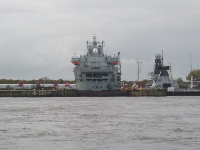
Cammell Lairds: Polar Research Vessel under construction
(aka Boaty-Mac-Boaty-Face) and two Fleet Auxilliaries being upgraded;
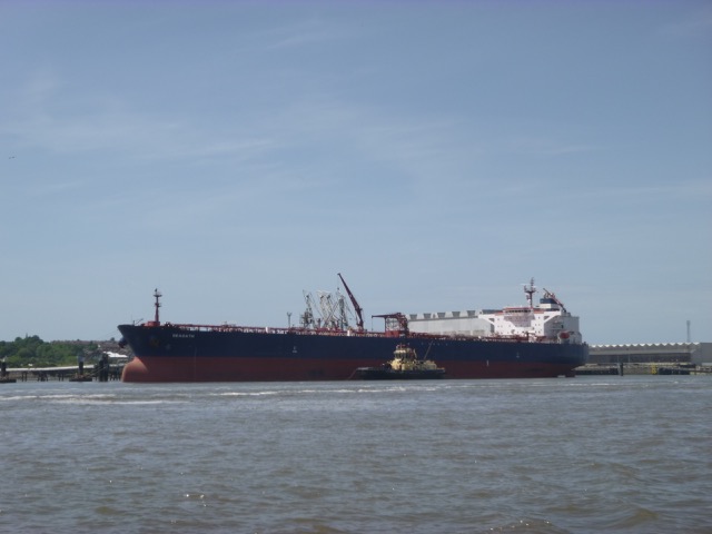
Oil Tanker Seaoath with tugs, ready to leave Tranmere Oil Stage:
Vessel Britain alongside at Carmet (ex-McTay) yard [Built Dublin
1910 as Lightship Penguin, 100ft long, for the Daunt Rock station, on
the western approach to Cork near where the PS Killarney was
wrecked, then converted in 1966 to a sea training vessel Halloween,
then converted in 1980 to a 3 masted schooner Arctic Penguin, then
alongside at Inveraray as a Maritime Museum until 2015 when it was
bought to be restored to a 3 masted motor yacht, to be based at Barrow].
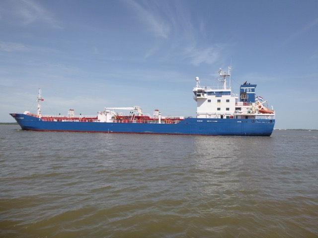
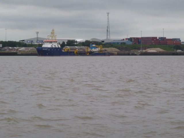
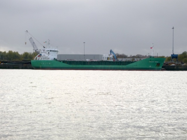
Stella Virgo outgoing from the Manchester Ship Canal, near Eastham:
Reach Eastham by 2:20 and head across to Liverpool Sailing Club House, on north shore, west of airport.
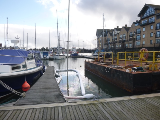
Pass Garston at 2:55 and lock in to Liverpool marina at 3:40.
Reggedijk leaving Garston, with houses at Gassendale beyond,
Monday 6 June (Liverpool HW 13.44 9.1m). Wind slight E 2 then calm; overcast.
Enter river from marina at 12:00. [one sailing boat also locked out]
Calm weather. Overcast.
Head up Garston Channel. Leave Garston channel at G11 (SHM) and head
for waypoints MER0,...MER7. (see
here for navigation info, some history and more photos).
This enables me to check that my waypoints, though not optimal, are
still useful.
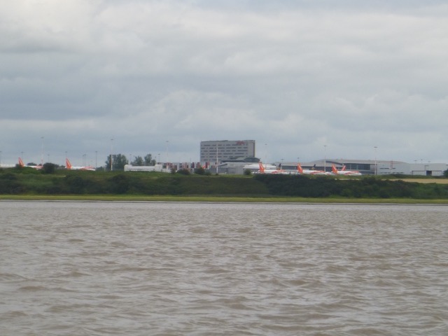
Passing Liverpool Airport, the Easy Jet planes parked up were conspicuous.

Cross south of Hale Head at 1.00pm and proceed along north bank up
to the Runcorn bridges. Lighthouse:

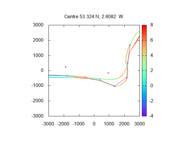
Depth (in metres above CD) of my tracks passing Hale Head [on way up I
followed waypoints (joined with lines), while on return I cut across]
Go through north arch (of three) of the railway bridge at 1.20. No other boats on the Mersey.
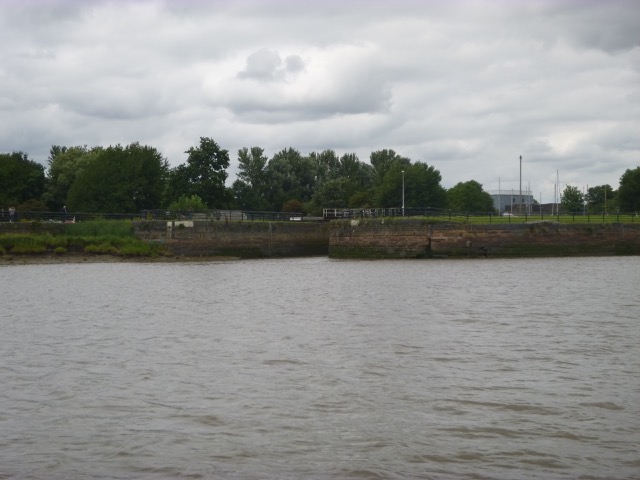
Follow south bank passing (abandoned) lock into Ship Canal, then head NE keeping close inshore - and avoiding the ruined quay which is an obstacle here.
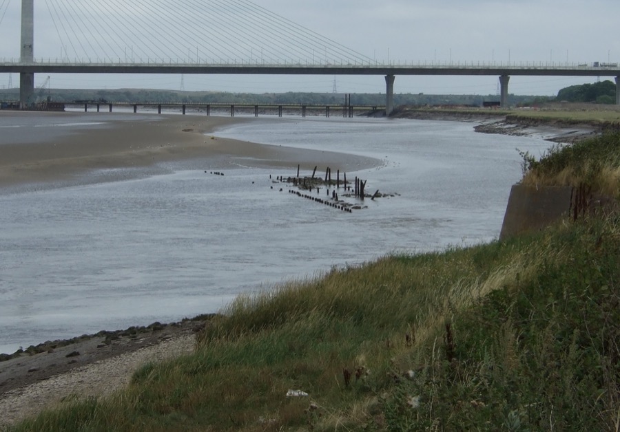
Passing under the (southern) span of the Gateway Bridge at 1:25. At
this state of the tide [1.5hrs before local HW at 2:54 at Fidler's
Ferry], there were still sand banks visible around the piers of the
Gateway Bridge [looking out towards the Runcorn Gap]: 
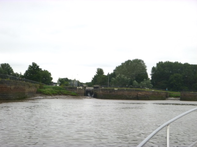
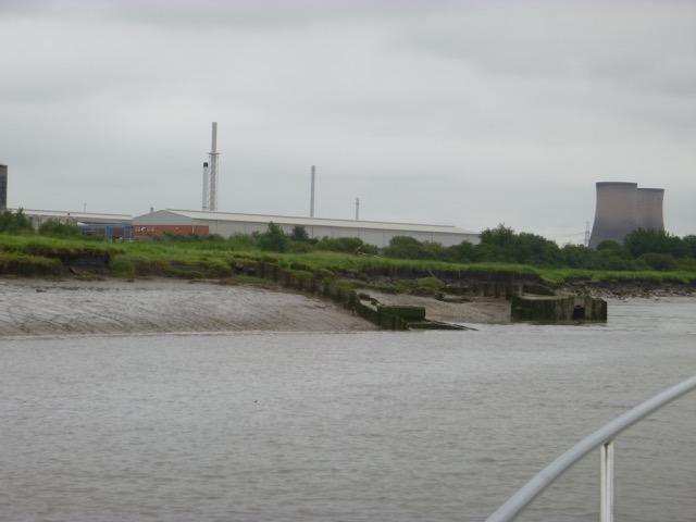
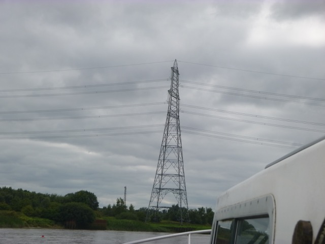
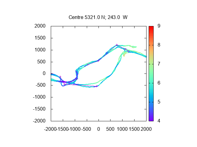
Keeping fairly close to the Runcorn side, I passed Hempstones Point and then the Pylon Crossing, at 1:40, which has a deep section close to the Pylon base. This gives access to Fidler's Ferry Reach - which is broader and where the deepest channel was not obvious.
With a strong up-river current, I ran aground at 1:50 - basically just bumped along for a few minutes - until back in water deep enough for me. This slight delay meant I had less "slack" in getting back to Liverpool Marina before the last lock at 3:40. So I decided to turn around and retrace my steps at 2:00, increasing revs to give me 9 knots through the water, so that I could punch against the incoming 2-3 knot current.
From this trip: Depths (above LAT) in Mersey from Hempstones Point, past Pylon crossing to
Fidler's Ferry Reach. Using Liverpool tidegauge depths, 60 minutes
earlier [scales in metres]:

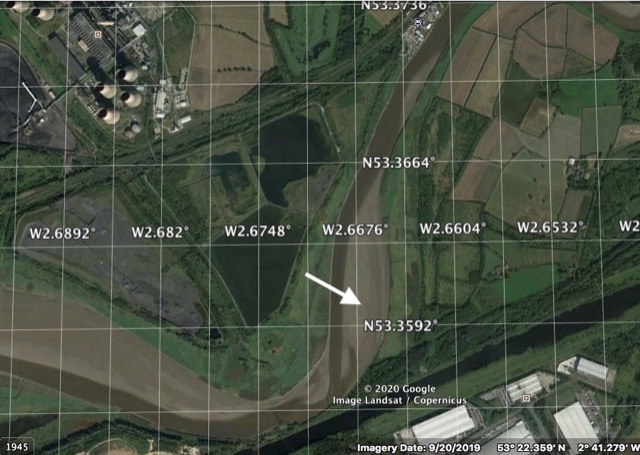
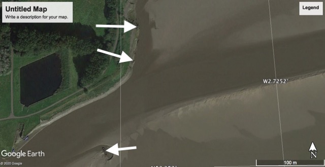
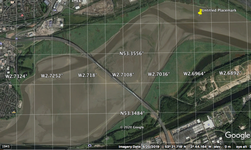
A Google earth image of the area (at middle) where I ran
aground [marked by arrow] - the channel seems to follow the west side now:
I found sufficient water on the way out - aided by my incoming survey and by the fact that the tide had risen - so that the sand bank under the Gateway Bridge was now mostly covered,
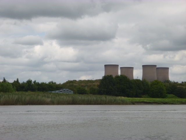
Fidler's Ferry Power Station seen through the Gateway Bridge:

I was under the Gateway Bridge at
2:14 and under the older bridges (rail and road) soon afterwards. I
tried to keep out of the deepest part of the channel, to have less
adverse current.
It was very calm. By 2:44, I was passing Hale Head and I
was in good time since the current was slack by now and it usually
takes me about an hour from Hale Head to the marina.
I entered the marina lock at 3:35.
30.9 nautical miles run.
Wednesday 24 June (Liverpool HW 14.04 8.9m). Sunny, warm, calm.
Enter river from marina at 12:45pm with 3 other boats.
Head up Garston Channel, past Grassendale, Garston Docks, Liverpool Sailing Club, Airport Gantry, to Hale Head (reached at 1:40)
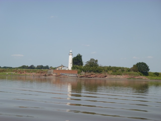
Hale Head light-house (disused)
Turn to go slowly round Bay just west of Hale Head - close inshore. Here current was adverse. See 6 herons. Some cyclists on the cycle path, but otherwise very calm and quiet - more so since the airport was only very occasionally sending a jet up.
Pass Dungeon Point (lattice perch) at 2:05, Garston at 2:25 and lock in to Liverpool marina at 3:30 (with 2 other boats)
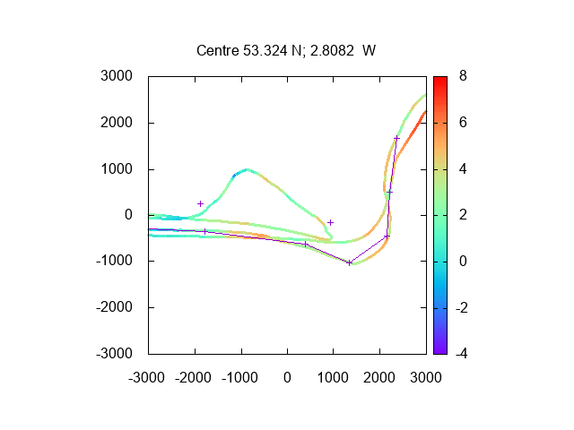
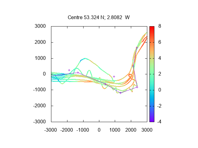
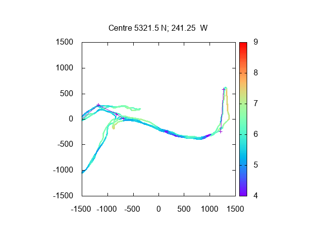
Depth (in metres above CD) of my tracks passing Hale Head from this
trip and previous one.[2019 waypoints, Dungeon Point and
Hale Head shown by +]
18nm run - at displacement speed.
Wednesday 8 July (Liverpool HW 14.10 8.97). Overcast, light wind from E.
Enter river from marina at 12:25pm with 2 yachts.
Head up Garston Channel, past Grassendale, Garston Docks, Liverpool Sailing Club (several small yachts sailing), Airport Gantry, to Hale Head (reached at 1:18)
Hopper dredger UKD Orca at work in Garston Dock entrance:
LSC yacht:
Depths, from 2020 trips, from Dungeon Point passing Hale Head (over CD at Liverpool
using tidegauge at Liverpool 30 minutes earlier):
It looks like my 2019 waypoints (shown with lines joining them) are no
longer optimum here - though they were still a rough guide. I have
updated my waypoints here .[see
below too]
Then close to North Bank and go through north arch (of three) of the railway bridge at 1.40. No other boats on the upper Mersey.
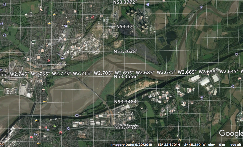
I have visited the Mersey above Runcorn many times - and always taken the channel along the south (Runcorn) shore. This was the only channel available during the construction of the Gateway Bridge. I was aware of an alternative channel, and - since the October 2019 Google Earth image shows a channel heading upstream that runs around the north shore - I decided to explore this, on a making tide.
GE image:
Pass close to Spike Island - West Bank Boat Club:
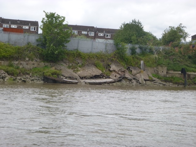
The bank close east of Spike Island is a bit of a graveyard for old Mersey Flats - including the Eustace Carey and Jane. Google Earth 2019 also shows the remains of a boat off shore at 53°21.134N, 2°43.749W nearby [looks like an abandoned small trawler: 11.5m long - this was reported on 23-9-2019 by Peel Ports as foundered in 53°21.137N, 2°43.749W - location of northern end of wreck]. These wrecks are covered near high water - so I could not see them.
Wrecks at LW near Spike Island - from Google Earth 2019:
Then passing under the (northern) span of the Gateway Bridge at 1:52. At
this state of the tide [1 hr before local HW], there were still large
sand banks visible around the piers of the
Gateway Bridge [looking up towards Hempstone Point]

Soon after passing under the Gateway Bridge, I passed some remains
on the shore [53°21.496N, 2°42.694W]- I could not work out what they
were. Checking the 1960 OS map - two outfalls near together are shown at
this location.
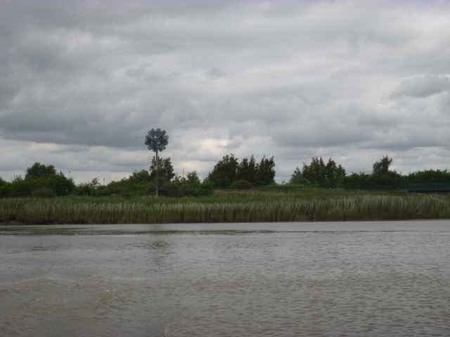
I continued along the north bank, following the waypoints. There is
a conspicuous "sculpture" here. At first, I thought it was a mobile
phone mast, but then I realised that it's art. This construction, powered by wind and
solar, was erected around 2010.
More details.
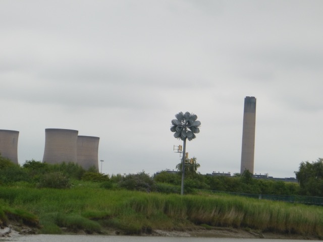
One of my waypoints is close to this sculpture - though I note that the 2019 Google Earth image shows some debris (wreck?) in the channel nearby at 53°21.645N, 2°42.310. This obstacle is also shown on the 2000 image
There are also bird hides here. I carried on close inshore - thinking that I was following the current around the bend - wrong - since the depth decreased steadily and, with a strong up-river current, I ran aground at 2:00 - basically just bumped along for a minute [position 53°21.598N, 2°41.718W] - until I was in water deep enough for me to return the way I came.
Position aground briefly - clearly not in the deepest channel:
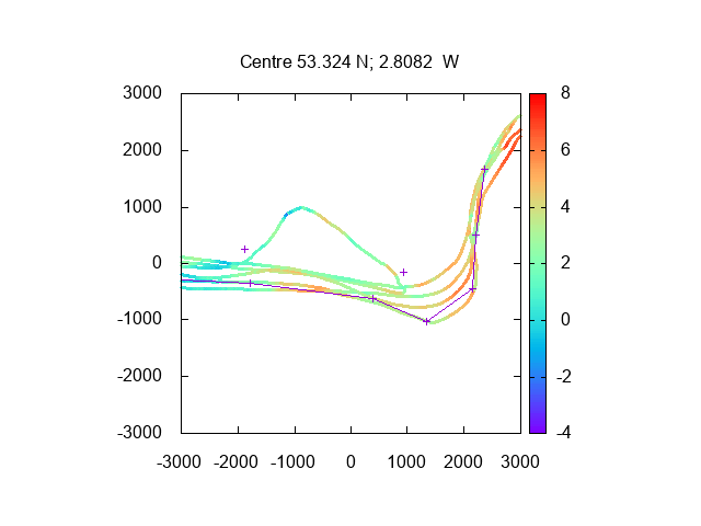
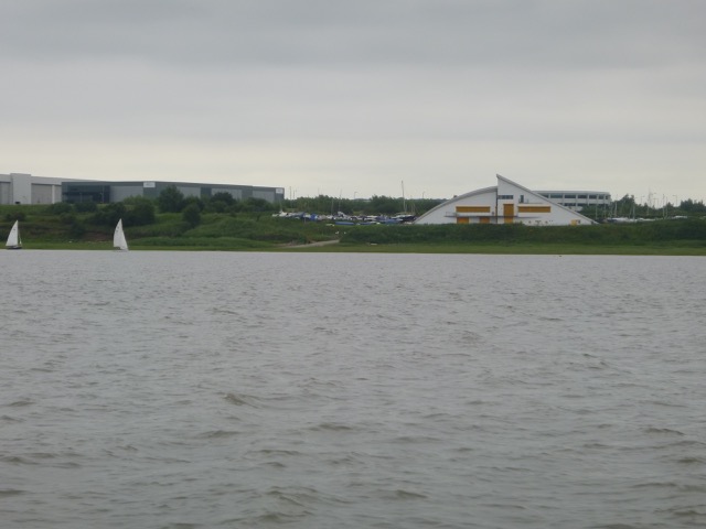
From this trip: Depths (above LAT), from this trip and earlier one,
in Mersey from Runcorn Gap up to Hempstones Point. Also lines joining
my waypoints. Using Liverpool tidegauge depths, 50
minutes earlier [scales in metres]:
I headed back out - with 2-3 knots of adverse current. So increased revs to give a speed of 9 knots through the water. On the way out, to minimise the adverse current, I kept out of the deepest part of the channel. On an incoming tide, there are back eddies off Widnes and off Hale Point also.
I was under the Gateway Bridge at 2:15 and under the older bridges (rail and road) soon afterwards. It was very calm. By 2:47, I was passing Hale Head and I was in good time since the current was slack by now and it usually takes me about an hour from Hale Head to the marina.
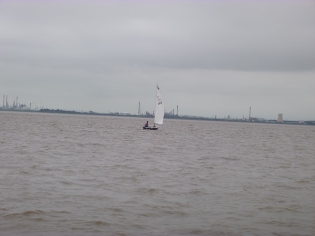
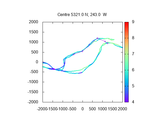
Sailing boats returning to Liverpool Sailing Club:
As I came close to the marina lock - I could see a cruise ship alongside the Liverpool Cruise Terminal. This is the Viking Sun, with no passengers on board, which is sheltering from strong winds and refuelling. The company has cancelled cruises until at least October 2020.
I entered the marina lock at 3:42 with survey vessel Proteus [thanks for helping me].
27 nautical miles run.
Tuesday 21 July (Liverpool HW 12.27 9.0m). No rain, calm.
Enter river from marina at 10:38pm with 1 other boat.
Head up Garston Channel, past Grassendale, Garston Docks, Liverpool Sailing Club, Airport Gantry, to Hale Head (reached at 11:35). There were 3 small yachts from Liverpool Sailing Club out, and Marine-Fire-1 passed me, heading up-river at speed.
Plan was to check deepest channel around Hale Head - so zig-zag keeping an eye on the depth gauge - while recording position and depth. The deepest channel was a bit further south than I expected - but has quite a sharp rise at its southern extremity in places.
Pass Dungeon Point (lattice perch) at 12:28, and follow deep channel, in part, towards the marina. Lock-ins are only hourly mid-week - so aim for 1:30 lock by increasing revs for a while. At 1:36 enter Liverpool marina lock (with no other boats)
Depth (in metres above CD) of my tracks passing Garston from this
trip and all previous 2020 ones.[with my waypoints, Airport gantry shown by +].
There is a deeper channel further south - but the more direct route
given by the waypoints is deep enough for me.
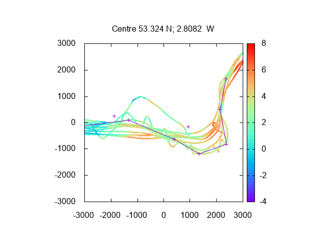
Depth (in metres above CD) of my tracks passing Hale Head from this
trip and all previous 2020 ones.[with new 2020 waypoints, Dungeon Point and
Hale Head shown by +]
21.9nm run - mostly at displacement speed.
Thursday 8 August (Liverpool HW 13.48 8.87). Overcast, light wind from S.
Enter river from marina at 12:02pm with 2 yachts and a motor boat.
Following 2020 waypoints; head up Garston Channel, past Grassendale, Garston Docks, Liverpool Sailing Club , Airport Gantry, to Hale Head (reached at 1:06), then follow north bank.
Easy jet aircraft parked up at Liverpool airport:
Depths, from 2020 trips, from Dungeon Point passing Hale Head (over CD at Liverpool
using tidegauge at Liverpool 30 minutes earlier) with 2020 waypoints:
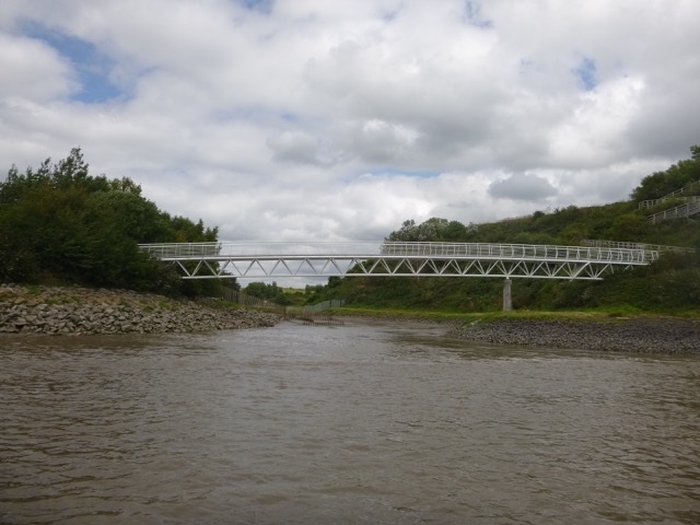
Pretty footbridge near TESCO at Widnes:
Then through south arch (of three) of the railway bridge at 1.40. No other boats on the upper Mersey.
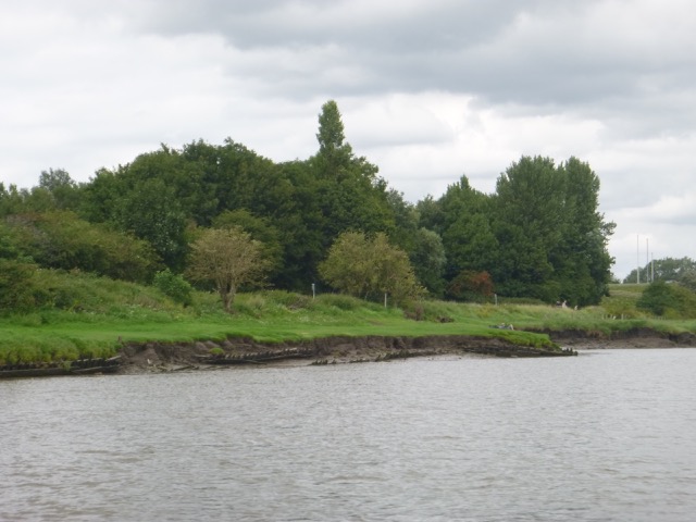
Pass close to Spike Island - West Bank Boat Club:
In this area there are some remains of wooden boats in the banks -
see above - presumably used to stabilise them:
Then passing under the (northern) span of the Gateway Bridge at 1:41. At
this state of the tide [1 hr before local HW], there were still large
sand banks visible around the piers of the
Gateway Bridge [looking across towards Hempstone Point]

I continued along the north bank, following the waypoints and turned
at the "flower art-work".
There are also bird hides here (power station beyond):
Unlike my trip in July, I turned sharply at the sculpture and headed towards Hempstone Point. This gave me enough depth to contine upriver, keeping close to the south bank, past the narrows where the pylons cross.
Pylon crossing, the river is narrow here and deep:
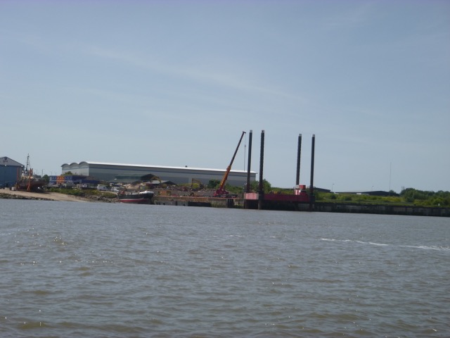
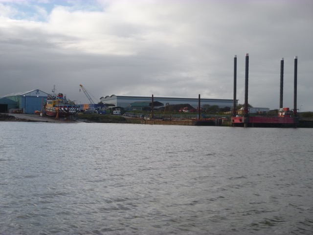
I reached Fidlers Ferry Reach at 1:56 and could see Fidlers Ferry
Boat yard:
At this state of the tide, there is not much depth from here on up.
See the tide-gauge results for that HW (from Fidlers Ferry and Liverpool
tide-gauges):
:
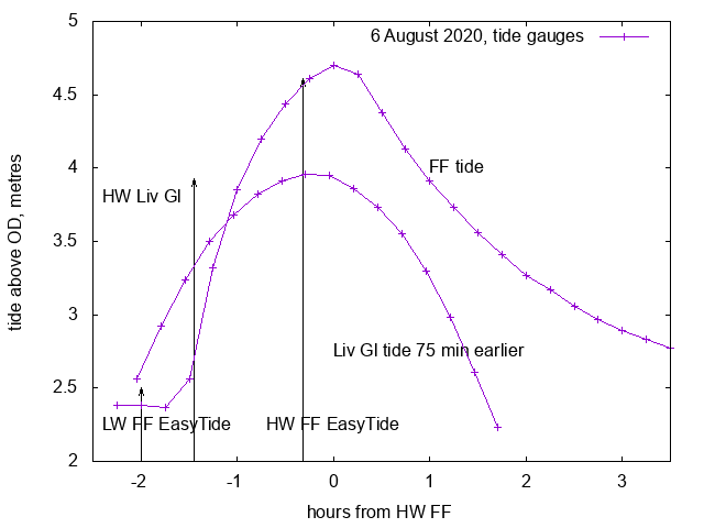
At 2:00, which corresponds to 1.25 hours before HW at Fidlers Ferry
tide-gauge (at 3.15), the depth is 1.4metres less than it will be at HW.
The current is streaming up river and the depth is increasing very quickly.
This is where I ran aground on my June trip. Depth
was also not great on this trip at that time, so I turned around to head
out at 1:57, since I wanted to get back to Liverpool marina by 3:45.
Depths (above LAT), from this trip and earlier one in 2020,
in Mersey from Runcorn Gap, past Gateway Bridge, to Hempstones Point.
Also lines joining
my waypoints. Using Liverpool tidegauge depths, 50
minutes earlier [scales in metres]:
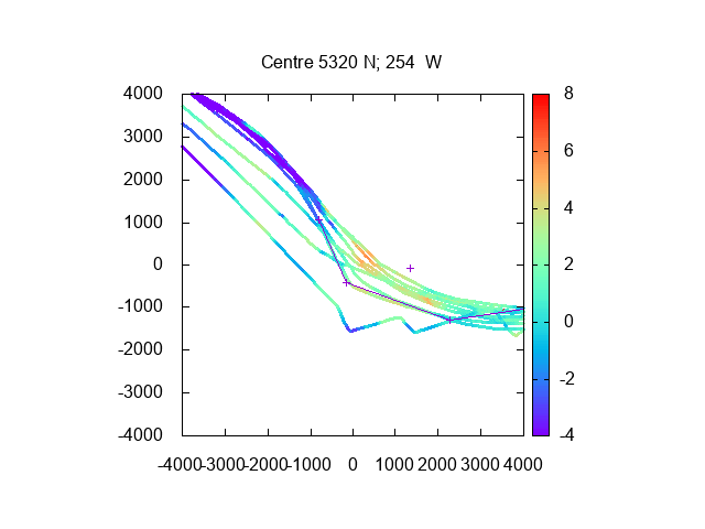
Depths (above LAT), from this trip and earlier one in 2020,
in Mersey from Gateway Bridge past Hempstones Point up to Pylon Crossing
and Fidlers Ferry Reach. Also lines joining
my waypoints. Using Liverpool tidegauge depths, 60
minutes earlier [scales in metres]:
Note that the comparison of Liverpool and Fidlers Ferry tide gauges
above shows that estimating the tidal height near Fidlers Ferry using the
Liverpool tide-gauge 75 minutes earlier is a very rough guide.
I headed back out - with 2-3 knots of adverse current. So increased revs to give a speed of 9 knots through the water. On the way out, to minimise the adverse current, I kept out of the deepest part of the channel. On an incoming tide, there are back eddies off Widnes and off Hale Point also.
I explored returning via the Runcorn shore at the Gateway Bridge (as used by me in June), but the depth decreased sufficiently that I turned and went out the way I had come in.
I was under the Gateway Bridge at 2:17 and under the older bridges (rail and road) soon afterwards. It was very calm. By 2:43, I was passing Hale Head and I was in good time since the current was slack by now and it usually takes me about an hour from Hale Head to the marina.
I entered the marina lock at 3:35 with two yachts.
30.9 nautical miles run.
Wednesday 4 November (Liverpool HW 12.51 8.8m). Mostly overcast, cool, some gusts.
Enter river from marina at 12:00pm with HMS Charger and a rib.
HMS Charger in the lock
Head over to Cammell Lairds shipyard and then proceed up river towards Eastham:
Vessels under repair at Cammell Lairds:
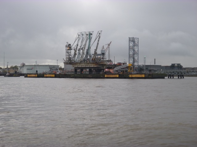
A very big shed, and a jack-up rig:
Fleet auxilliaries
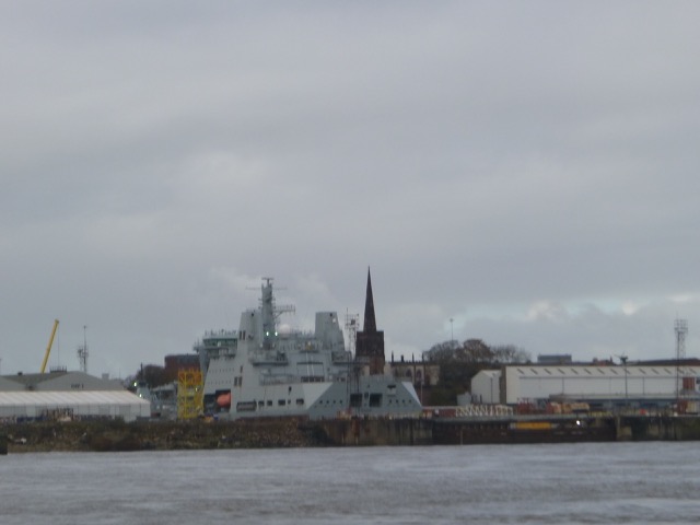
Oil Tanker stage at Tranmere:
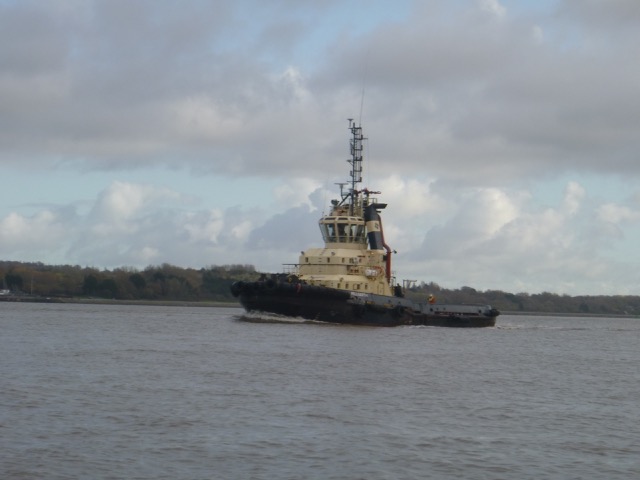
Tug Millgarth waiting nearby:
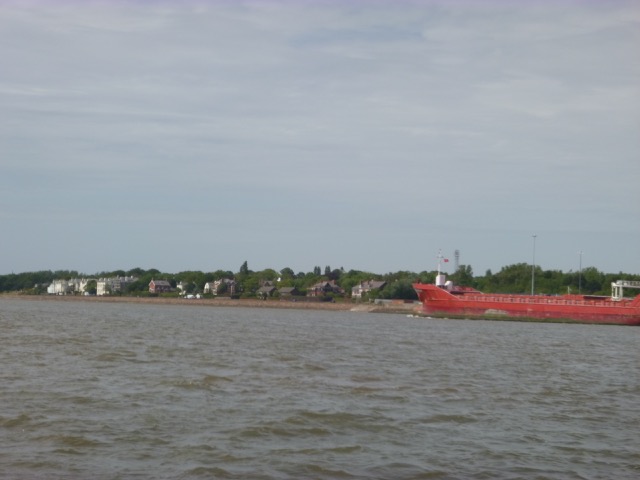
Arklow Rogue alongside at Bromborough:
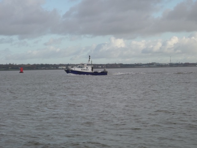
MDHB survey catamaran Royal Charter:
Carmet shipyard: Mersey Ferry on the slip:
Returning to the Marina about 30 minutes before HW Liv(Gladstone), I was surprised to find that the current was still 2 knots inward. After giving the engine a chance to warm up thoroughly, lock back in at 12:50. [only boat]
Near my berth was a sorry sight - a yacht sunk alongside the pontoon.
Only 6.9 nm run.
If higher resolution versions of the above images are wanted, please contact me. All information given in good faith, but please do not rely on it.
Back to index here