Thursday 1 June. High pressure. Sunny. Cloudless. NE 2-3. Leave Liverpool Marina at 11:18 - only boat (HW 9:47 8.3m; LW 16:40 2.1m; HW 22:14 8.5m). The water level in the marina seems to be lower that usual - which meant the lock out was quicker.
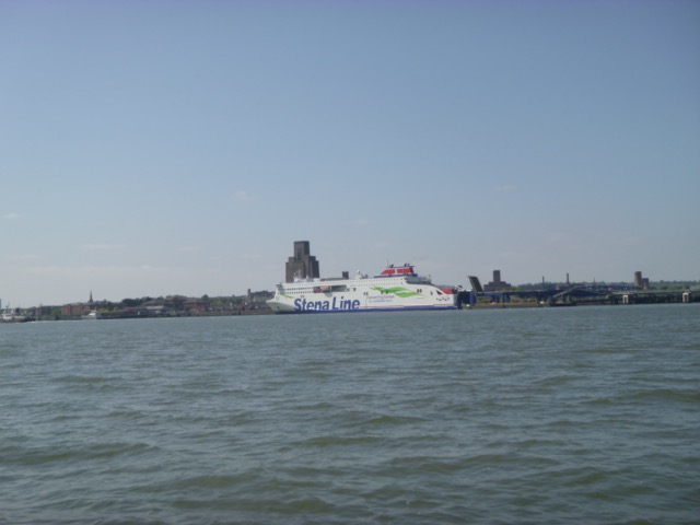
Stena ferry Edda [41671 grt; later passed us en route for Belfast] at
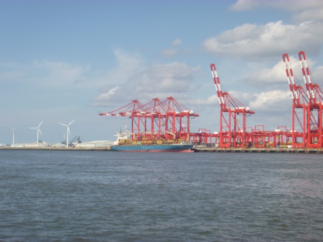
Birkenhead in-river terminal.
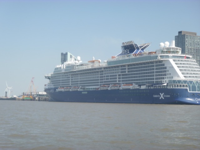
Huge cruise ship Jewel of the Seas [293m long, 32m wide; 90090grt;
2700 passengers; later left for Cork] berthed at Pier Head 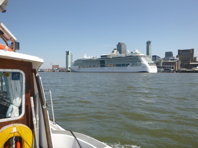
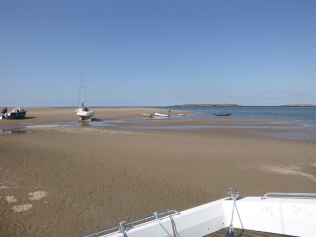
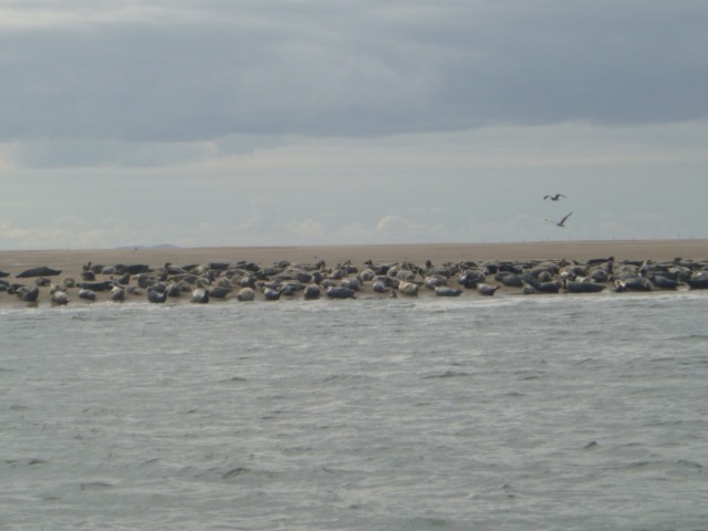
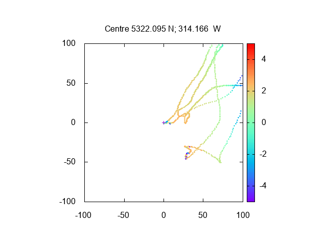
Follow my usual waypoints - Corner - He3 (at 12:55)- Hilbre Point (at 1:20). Survey drying out area, then run aground at 2:10 at 53°22.095N, 3°14.166W. This proved at be on the flat area just off the edge of the bank - with firm sand. The drainage channel close to the edge of the bank seems no longer to be of any depth. The usual congregation of seals were on the tip of the bank - and we were far enough away not to disturn them. There were several other boats aground nearby - with some live music to be heard, along with the moaning of the seals. Time for some barnacle re-homing and to replace the anode on the stern gear.
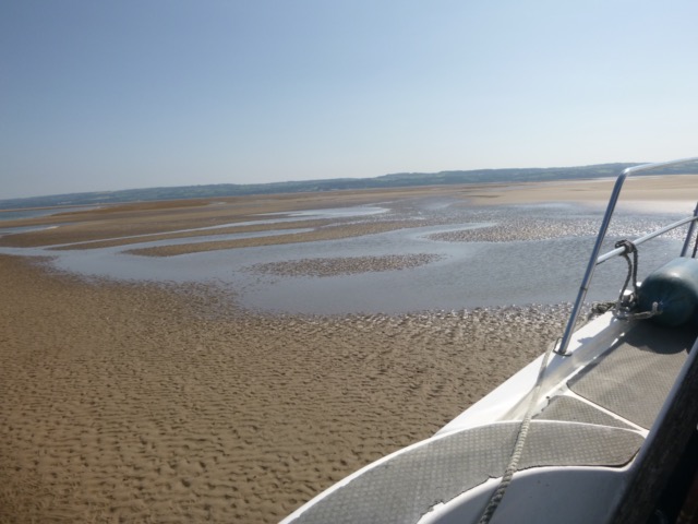
Views from Marlin aground towards Hilbre and towards Mostyn.
Depths (in metres above CD) on my way to and from anchorage.

At 6:15, I refloated and headed back to Liverpool, by the same route. NE 3 meant a bit of chop with wind aginst current.
Lock into Liverpool Marina at 8:25 - with one other boat.
Distance run, mostly at tick-over, 28.9 nm.
Thursday 15 June. High pressure. Sunny. Cloudless. SE 2 or less. Leave Liverpool Marina at 11:54 - only boat (HW 9:44 8.6m; LW 16:36 2.1m; HW 22:18 8.5m).
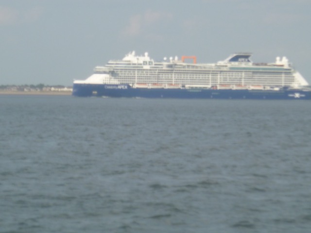
Pass cruise ship Celebrity Apex [130,818 GT, 3405 passengers,
returning from Iceland, en route to Rotterdam] on the pierhead terminal - she left
that evening.
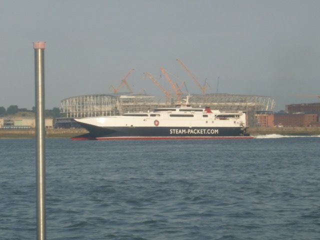
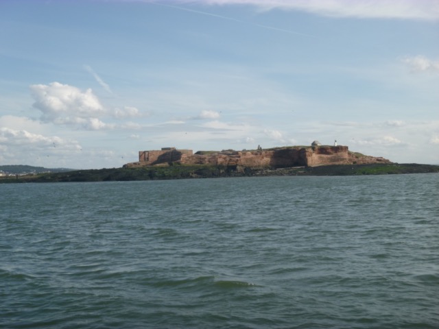
Pass continuing work on new Isle of Man terminal [reported divers at work, so vessels asked to pass slowly] - with jack-up rig; passed by Seatruck Pace which entered from Langstone lock; also ferry Royal Iris on its cruise to Tower Buoy and back.
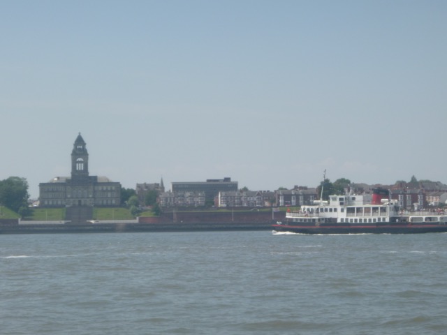
Royal Iris with Wallasey Town Hall behind.
Head into Rock Channel. Check my waypoints for the best route; then explore some wreck-sites. Use sonar to see if any signal of interest.
Then head north (keeping just east of the Burbo wind-farm) to cross the shipping channel near buoy Q11. This involved crossing both south and north training walls - OK for me at that tidal depth.
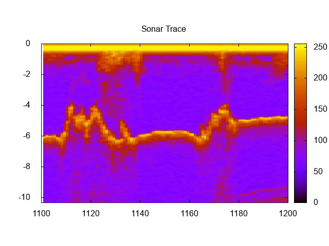
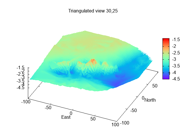
My main target was to survey carefully the wreck of the SS Valeria, sunk 1918 [and dispersed by MDHB to reduce its impact]. I am able to store the sonar display - so I can analyse it afterwards. Weather was fine and very calm - ideal for looking for seabed features.
There is certainly wreckage here - one part of the sonar scan [actual depth
in metres, signal strength as colour, pings are every second, so approx 2m apart]:
There seems to be a line of wreckage in a gully [here depths below
CD]:
Near LW I decided to anchor to have a siesta. It was nice and calm for a snooze. The current seemed to be slack about 4:40 - ten minutes after predicted LW at Gladstone Dock. I set off again at 5:15 to retrace my steps. As I approached the shipping channel, Stena Edda was coming in, so I waited until she passed before crossing the channel - the two training walls had depths of 1.7m and 2.5m under my keel, around 5:40.
I then headed to a wreck site near the entrance to Murphy's Gut - to get more data - I believe this site to be the wreck of PS Superb in 1835.
After that survey, I headed slowly in along Murphy's Gut - to check depths had not changed. I then motored slowly into the Mersey - waiting just north of Egg buoy, where there is little current.
Manannan passing the future Everton Football Stadium
Lock into Liverpool Marina at 8:20 - with two other boats [a windfarm boat and a large yacht].
This trip involved lots of local knowledge - and I had checked obstructions myself by viewing at low water. I do not recommend crossing the training walls, or passing through Murphy's Gut [which runs very close to the training wall].
Distance run, mostly at tick-over, 28.8 nm.
Thursday 13 September. Highish pressure. Mostly overcast, SW 2-3, calm. Leave Liverpool Marina at 13:22 - with a wind-farm boat and a work-boat (HW 11:21 8.5m; LW 17:54 2.4m; HW 23:32 8.9m).
Head slowly round to the Hoyle Bank - since I did not want to dry out too soon. As well as saying "hi" to the seals, plan to investigate and rectify the sluggish performance of the boat, since divers had reported extensive fouling of the propellor.
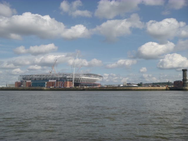
Pass the new Isle of Man terminal under construction:
Pass the Everton stadium under construction - here with Anfield just
visible on the horizon to the right of it.
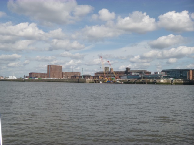
MSC Passion on the Seaforth in-river container terminal
At 1:54 pass Brazil buoy and head into the Rock Channel, following my
waypoints. The white racing mark "chip" was still present.
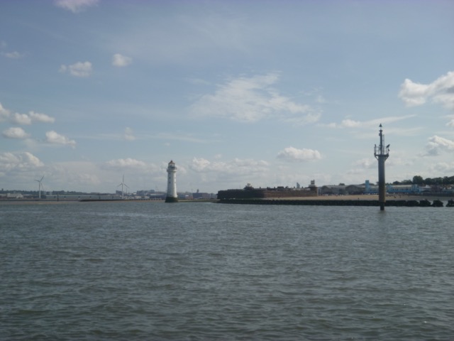
Perch (no 11) marking the groyne with the Rock Lighthouse (disused) beyond:
Proceed along North Wiral coast, fairly calm since sheltered from
wind, passing HE3 at 3:06 and Hilbre Island at 3:27.
Reach HE4 by 3:40. The seals at rest:
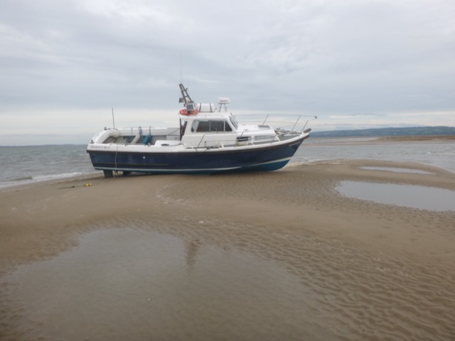
Drive aground at 3:47 [LW Liverpool -2:20] at
53°22.022N, 3°14.141W. Fairly hard and clean sand. As the tide
ebbed, hop overboard to remove some weed and take stock of the
stern-gear. I had not used the boat, because of adverse weather, for
over 2 months during the summer - which gave the tube worms time to
build up. In 30 years of boating, I have often had to remove a handful of
barnacles, but I have never experienced such extensive fouling. Moreover
motoring at 1800 rpm had not dislodged them.
Evidence from Whitehaven marina (2014 on), Douglas and Peel marinas
(2023), suggests that this is a non-native invasive species: Australian (or trumpet)
tubeworm (Ficopomatus enigmaticus) which has moved north from the South
Coast, and which flourishes in brackish water, such as marinas.
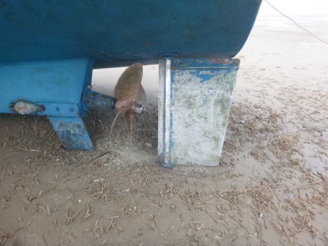
The fouled prop (after the rudder had been scraped a bit cleaner):
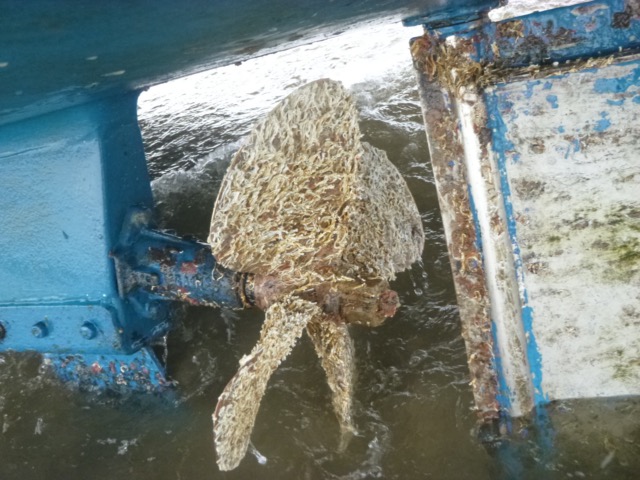
After much scraping, the pesky tube-worms had all been dislodged:
Low water seemed to be just before 6:00, and the level was quite
close to my position. So I must have been on sand at about 2.6m above
CD. The drainage channel that used to run out close to the higher
part of the Hoyle Bank has now completely disappeared - leaving a shelf
about 2m above CD on which I was aground. There was a small drainage
channel just S of my position:
Refloat at 7:15, a bit exposed to waves from the S, and chug back with a fully functioning prop. It got dark about 8:10. Quite lumpy in Mersey. Lock in to Marina at 9:30, only boat.
Depths (in metres above CD) on my way to and from anchorage, 2023,
this trip further south:.
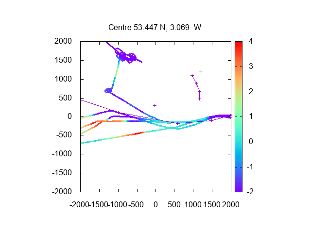
Depths (in metres above CD) through Rock Channel from 2023 trips (red
is crossing North Bank near HW).
If higher resolution versions of the above images are wanted, please contact me. All information given in good faith, but please do not rely on it.
Back to index here