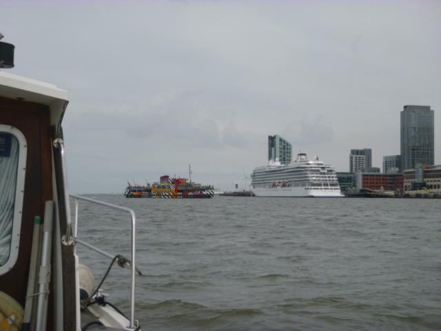
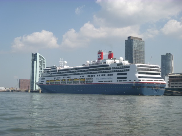
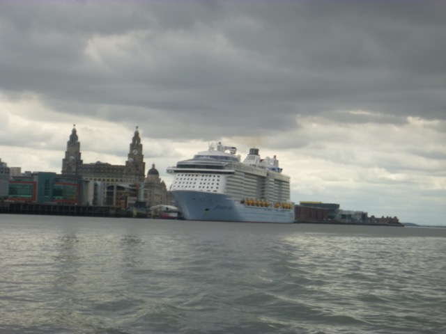
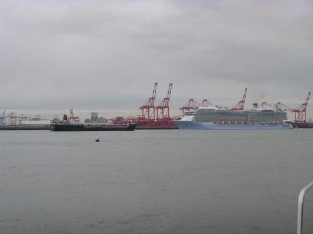
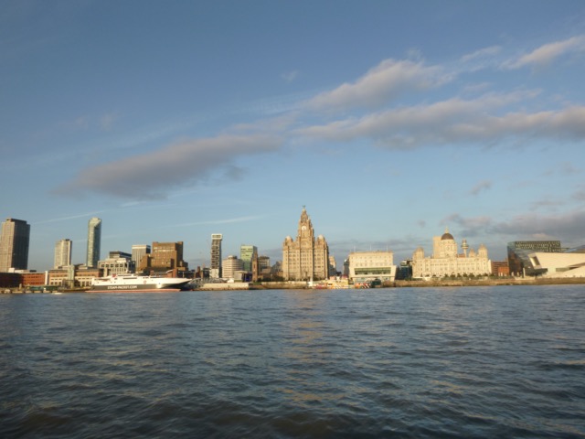
Cruise ship Viking Venus (also "dazzle" ferry) alongside at Cruise Terminal [Viking Venus is new, 47843 gtons, 930 passengers, and doing 7 day round England cruises from/to Portsmouth; excursions offered at Liverpool are "bubble" trips]
Jump to: June
Jump to: July
Jump to: August[to Liverpool Bay]
Jump to: September
Monday 7 June. High pressure. Leave Liverpool Marina at 11:30 (HW 10:07 8.2m; LW 16:53 2.2m; HW 22:34 8.3m). Calm and sunny. Though onshore breeze built up.
Proceed past New Brighton (at 12:05) and through Rock Channel, following my waypoints.
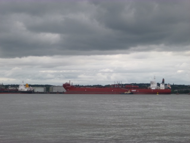
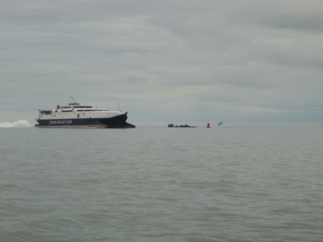
Shipping seen in Mersey:
Cruise ship Viking Venus (also "dazzle" ferry) alongside at Cruise
Terminal [Viking Venus is new, 47843 gtons, 930 passengers, and doing 7
day round England cruises from/to Portsmouth; excursions offered at
Liverpool are "bubble" trips]
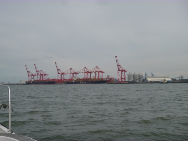
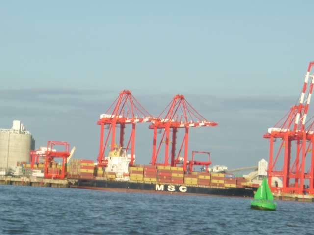
Container vessels (and a tug) on the Seaforth in-river container terminal.
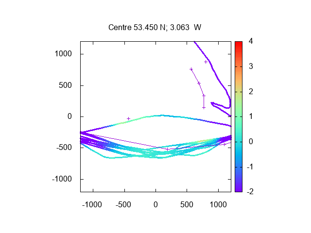
Rock Channel: I followed my waypoints
Perch - Chip - Corner and found the seabed dries
by no more than 1.0m at CD. There was a white spherical buoy near "Chip"
- a race mark.
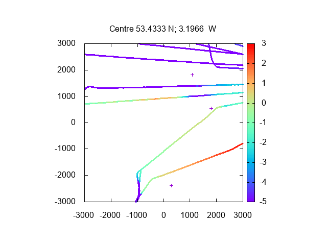
Seabed survey of Rock Channel (lines join waypoints) (as depth below
CD) from my 2021 trips [upper track is the Rock Gut]:
I then headed from my waypoint "Corner" to my waypoint for crossing the East Hoyle Spit and then on to the He3 buoy.
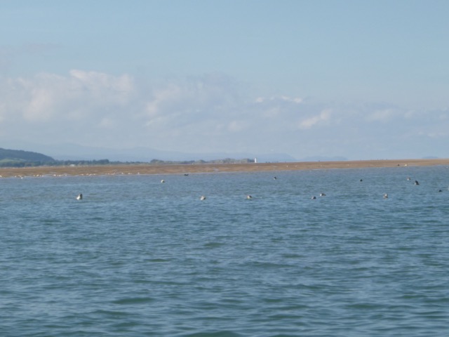
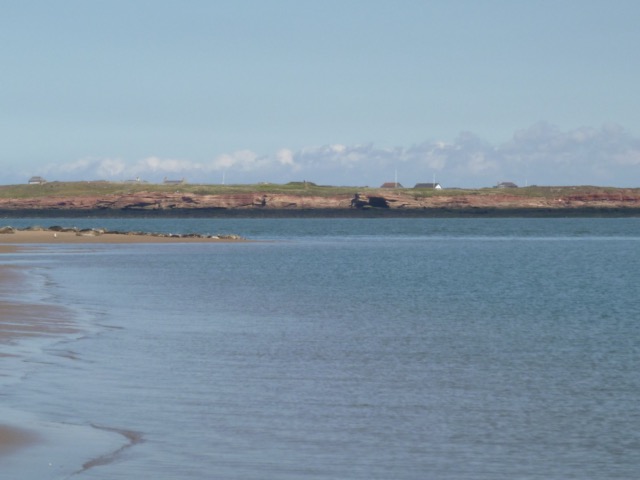
I rounded the end of Hilbre Island at 1:25 with adverse current. The Hoyle Bank was still covered - so no lounging seals.
I decided to check my waypoints for access to Thurstaston. I arrived at the entrance at 1:55 and headed for waypoint THE (close to a cylinder buoy marked SH.. ). I had only 1.2m under my keel in places - so decided to turn round - to avoid getting stuck with delay in refloating. Depths seem similar to those of previous years.
Survey (2021) of entrance to Thurstaston - with my waypoints
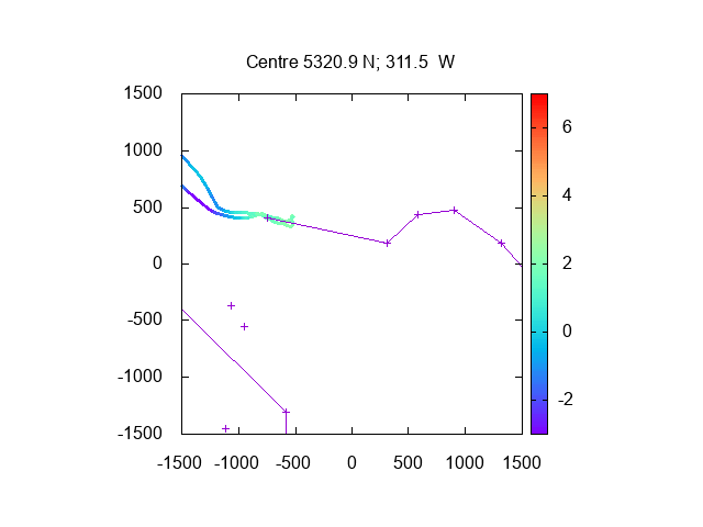
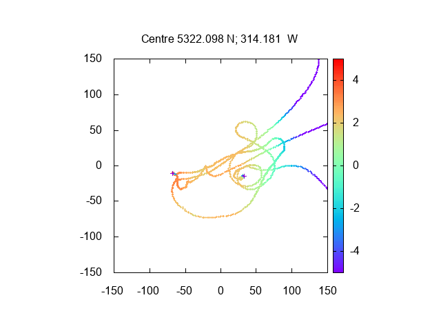
I then returned to the Hoyle bank, at 2:20, which was now partly dry with seals resting. I wanted to be able to get back to Liverpool Marina by first lock (tidal height 6.5m), so surveyed the area just south of the SE point of the Hoyle bank - looking for a suitable spot. There was a flat area and I anchored there at 2:30, with 0.6m under my keel. Position where I dried was 53°22.090N, 3°14.151W. The edge of the bank has moved (to SE) since 2020, so my previous survey is redundant.
Survey results (2021) of Hoyle Bank anchorage (depths metres from
CD)(+ marks previous years' locations)
After the tide ebbed further, I went
overboard to do some maintenance to the wooden strakes along the hull.
At low water, I was dry but close to the LW line.
At this location, the seabed depth was about 2.2m above CD, using
Liverpool tidegauge data. So just at LW level [2.2m] on that day.
I also took a walk around - taking care not to disturb the seals.
There was a drainage channel right next to the Hoyle Bank - which was
just under knee deep to cross.
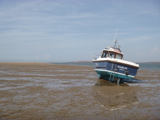
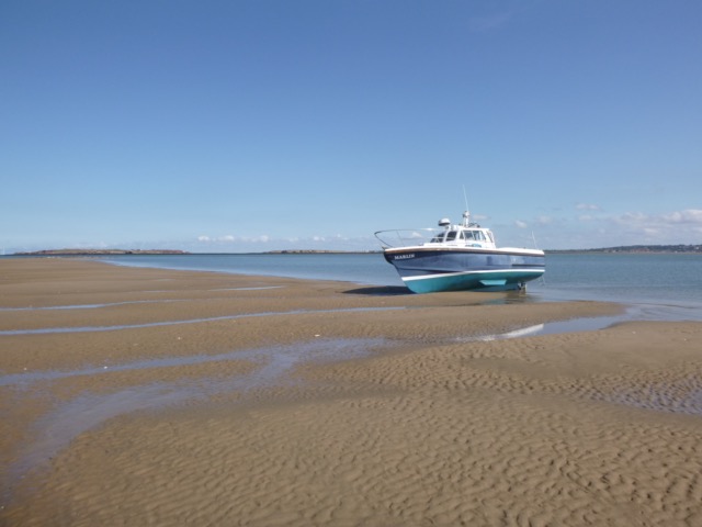
Marlin aground (He4 to left, Hilbre to right):

Drainage channel(Hilbre ahead, He4 and seals to left, Marlin to right):
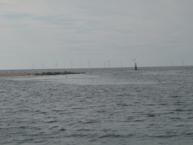
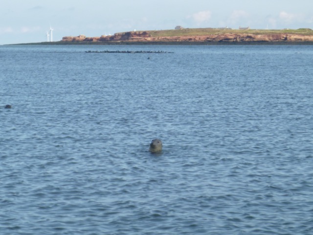
Seal resting on Hoyle Bank with Burbo windfarm in distance

There was a sea breeze - so sunny but not very warm. The sea was sheltered behind the Hoyle bank, so Marlin took the ground gently.
I was afloat again by 6:15 and returned via Hilbre, He3, my waypoint Corner, the Rock Gut, into the Mersey. The direct route from there to Corner crossed the North Bank at 7:40pm with least depth of 0.9m under my keel.
Seals resting with He4 buoy.
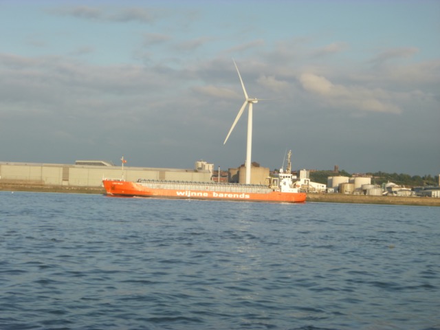
Vessel Cemcoaster [98 x 15 metres, built 2020, taking cement from
Runcorn to Santander] heading out
Reach Liverpool Marina by 8:30. There were 2 other boats waiting to enter; a windfarm boat and a yacht. After a boat left, we entered the lock at 8:43. Then there were problems - the inner gate would not open and an electrical fault had to be fixed. So we finally got into the marina at 9:45.
The Canal and River Trust has responsibility for the lock gates - and despite a extensive (and much extended) refurbishment, all is still not well.
Trip out 19nm, back 14nm.
Thursday 22 July. High pressure. Leave Liverpool Marina at 11:30 (HW 10:17 8.6m; LW 17:09 1.8m; HW 22:45 8.9m). Calm and sunny. Hot.
Proceed past New Brighton (at 12:05) and through Rock Channel, following my waypoints.
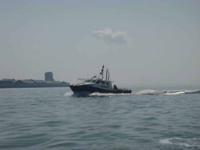
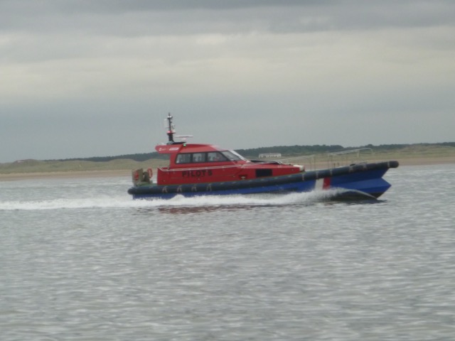
Shipping seen in Mersey:
Cruise ship Borealis (Fred.Olsen) alongside at Cruise Terminal
Survey vessel Royal Charter
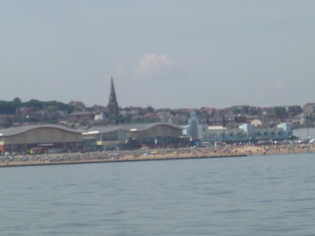
New Brighton beach already fairly full:
Pass through Rock Channel (12.00 on). Then drift in calm weather to eat lunch and fix a few boat issues.
Pass He3 at 1:35 and then pass end of Hilbre at 1:52. The Hoyle Bank
was already dry, though the part with the seals on was only just dry.
Head into shallows to find a place to anchor (at 2:17 with 0.7m under my
keel) to dry out in shelter as the tide went out.
Eventually aground at 53°22.093N, 3°14.169W at 3:30.
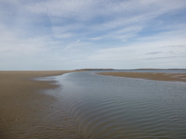
Channel draining SE edge of Hoyle Bank
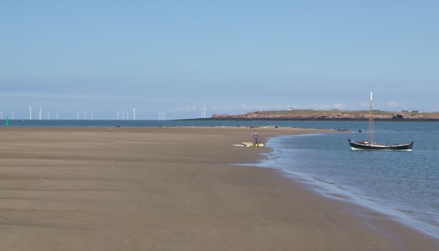
Marlin sporting a new anode:
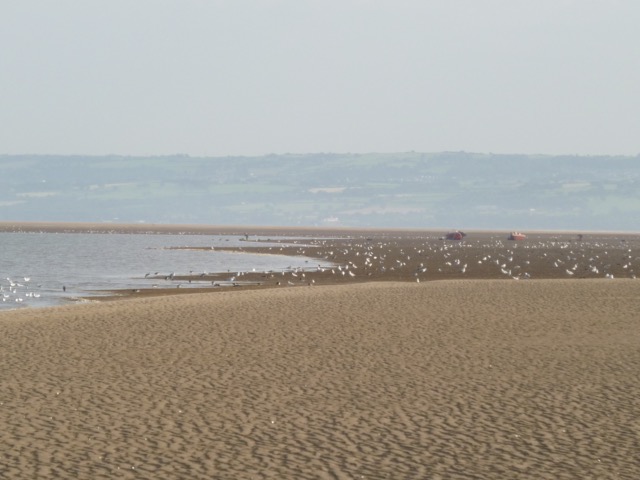
Salisbury Bank had a number of small boats - the cockling fleet.
Some cockle collectors:
I was afloat again by 6:36 and returned via Hilbre, He3, my waypoint Corner, the Rock Gut, into the Mersey. The direct route from there to Corner crossed the North Bank at 7:50pm with least depth of 1.0m under my keel.
No longer a world heritage site:
Reach Liverpool Marina by 8:30. There were 2 other boats waiting to enter; a windfarm boat and a yacht, we were all in the lock by 8:45.
Trip out 14nm, back 14nm.
Friday 20 August. Calm conditions forecast. Leave Liverpool Marina at 12:22 (HW 10:18 8.4m; LW 17:03 2.2m; HW 22:40 8.8m) with one other vessel. Calm and mostly overcast with some rain in evening.
Proceed past New Brighton (at 12:53) and through Rock Channel, following my waypoints.
Shipping seen in Mersey:
Oil tankers on the Tranmere oil stage
Cruise ship Anthem of the Seas [Royal Carribean; 4905 passengers
maximum, 168,666 gtons, cruising around the UK from Southampton ]
on the Cruise Terminal
I headed for the area west of the Burbo (extension) windfarm since it
might have clearer water and more chance of catching fish on feathers.
I passed the SW corner of the Burbo Windfarm at 2.30. A fishing charter
vessel was anchored nearby - and reported almost nothing caught - which
was a bit discouraging.
I towed a trace on a paravane for a while and then stopped to
jiggle my lures. Nothing doing. To add insult, a large seal popped its
head out nearby and looked at me for a while - as if saying "no chance mate, I've
eaten all the fish".
Having tired of failing to fish, I decide to go back to my main
interest - wreck detection. The wreck of a Liverpool Pilot Schooner,
Mersey, was charted nearby. She was a wooden 2-masted vessel, sunk in 1885 by
collision.
I had failed to find evidence of the wreck using my rather primitive sonar many years ago.
I had, however, seen a report by a windfarm survey vessel that a sonar signal had
been detected nearby.
They reported in 2013 a posible wreck
of extent 33 by 14 metres, about 0.2metres proud of the seabed.
The location is quite close to a wind turbine but more than 25 metres
away, so navigation (but not anchoring) is allowed.
I surveyed this location by Humminbird sonar. I found a distinct area
raised above the seabed around the reported position: 53°29.994N,
3°20.159W. This is near (about 65 metres) the position reported in 1885
by MDHB (and repeated in 1967, listed in WLBv2 and charted) as the wreck of the Pilot
Boat Mersey. So another potential wreck for divers to explore.
As it was coming up to low water, with a predicted height of 2.2 metres, I decided to use this opportunity to explore the training walls. It was quite calm, so I could have seen any rocks drying as I entered the shipping channel. None were visible. I looked for the wreck of the Blair Nevis, which dries north of the channel - it was sufficiently far away that I was unsure if it was drying at that time (5:25). My previous visit to the site was on a much lower tide (1.2m above CD) when it was dry by about a metre or so - so it would not have been visible since the tide was about 2.5 metres above CD as I passed.
Taylors Bank was dry and there was a
sandbank just beaking the surface near C7 buoy at 5:50 [LW+45
minutes]
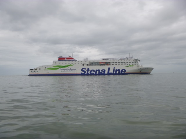
Stena Edda passing me, inbound
The first obstruction that I could clearly see was the wreck of the
Pegu. Here the Isle of Man ferry Manannan, inbound, is passing the Pegu
site, with Lennox gas/oil rig in the distance..
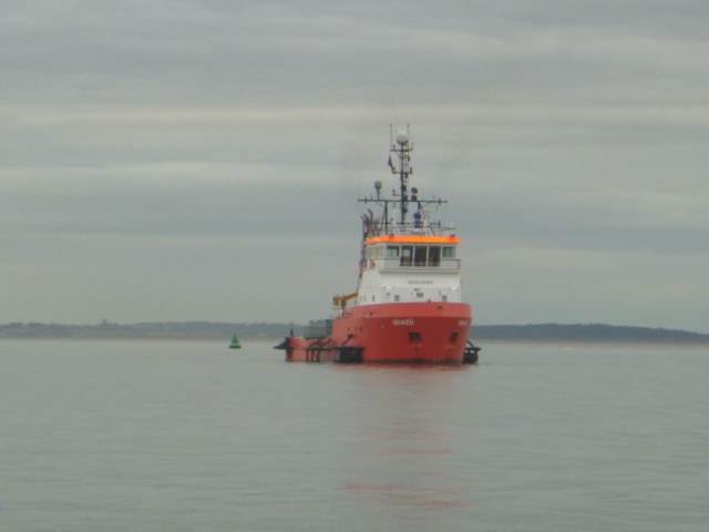
Further in, I was passed by a Pilot vessel and I passed the
water-injection dredger Iguazu:
As I reached New Brighton at about 6:30 and I could only lock in to Liverpool Marina after 8:30, I decided to stop over in Lagoon. This is a sheltered spot (marked by a race buoy) just W of the southern end of the west training wall. I anchored in calm conditions and not too much current.
As I waited, I could observe, from quite close by, the shipping
movements:
Naama Borchard [container vessel, 9981 gt]inbound (with Lagoon buoy in foreground):
Zuga [oil tanker, 4598 gt] inbound with Anthem of the Seas outbound:
I upped anchor at 7:30 and proceeded slowly to the Marina Lock, entering at 8:25. There was one other boat (the yacht that had left with me that morning).
Distance run, mostly at tick-over, 35.8nm.
Thursday 16 September. High pressure. Leave Liverpool Marina at 9:18 (HW 7:46 7.5m; LW 14:36 3.2m; HW 20:23 7.8m) with 2 other boats. Calm and sunny. Though still a slight swell from NW.
Proceed past New Brighton (at 9:53) and through Rock Channel, following my waypoints: Chip, Corner. Then head for E Hoyle crossing waypoint [shallowest area inside East Hoyle spit] at 10:50 then pass HE2, HE3 and head for N end of Hilbre (reached at 11:30).
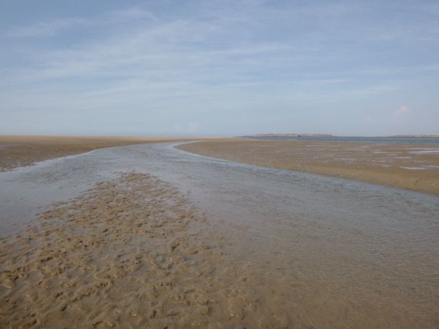
My intention was to dry out on firm sand just south of the Hoyle Bank. I usually select the flattish area separated from the main bank by a drainage channel. That flattish area only dries about 2.2 metres - so would not uncover today. I wanted to pick a spot that would allow me to float off and return to Liverpool Marina for the first lock (6:40pm: HW -100mins). The Hoyle Bank can be quite steep sided near the SE tip, so I chose a spot further from the seals and ran aground there at 12:00 (HW+4.25hours) at 53°22.092N, 3°14.242W. At this state of the tide, the extreme SE tip of the bank, where the seals congregate, was still awash.
Point of Ayr with seals waiting for the Hoyle bank to dry.
A nearby seal, and the group of them beyond, with Hilbre in the distance
Marlin aground:
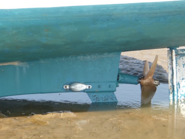
I duly took the ground and jumped overboard to remove some slime from the hull and "rehome" some barnacles that had selected my propellor for a base. At LW, the tide level was still only a few feet from my boat. After grovelling in the sand to sort the propellor, I took the opportunity to freshen up with a swim in the nearby gut - which had clear water, a sandy bottom and almost no current or waves.
Seals nearer LW:
A lovely spot - and I was not the only boat taking advantage (HE4
buoy at extreme left):
At 4:25, I was afloat and lifted the anchor (I deploy a light anchor in deeper water so that when I float, I can pull the boat into that deeper location). I then motored slowly back around the Wirral Coast to Liverpool (with a making tide, I could afford to venture into quite shallow water).
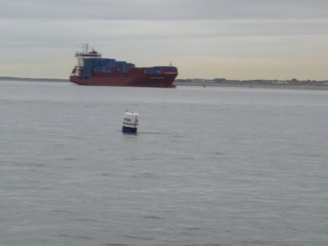
Some shipping in the Mesey on my return:
MSC Maria Pia on the Seaforth in-river container terminal (with
Brazil buoy):
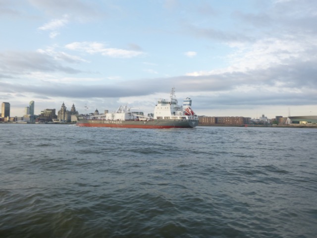
Lady Nola outbound (with Anfield stand just visible):
Pier head looking good in the evening sun (with Isle of Man ferry
Manannan and Mersey ferry Snowdrop):
Survey (depth above CD) of areas from my 2021 trips
Near SE tip of Hoyle bank - drying out area:
Rock Channel - between waypoints Chip and Perch from 2021 trips
(seems to dry less than 1m):
Crossing inside East Hoyle Bank (waypoint shown by +; HE2 and HE3 at
middle bottom; also shows one track crossing over a higher part of the East Hoyle Spit):
Lock into Liverpool Marina at 6:45 with 2 fishing boats (my thanks to Blackdog for a donation of mackerel),
Distance run, mostly at tick-over, 25.6nm.
If higher resolution versions of the above images are wanted, please contact me. All information given in good faith, but please do not rely on it.
Back to index here