
Why the name?
In 1964, and taking into account areas of land under prior agreements for access and essential services, an area of land ownership at Caldy was passed to the Council by sisters Eveline and Ivy Cubbin in memory of their parents William and Mary Jane Cubbin. The conditions of the land transfer were that the land was to be "kept open and unbuilt upon and henceforth shall be known as Cubbin Green".
The background to this was that William Cubbin (b 1853, as William Cubbon, at Port St. Mary - then also called Port-le-Murrie - Isle of Man) was proprietor of a Company based in Poulton Bridge Road (with slipways on the side of West Float, Birkenhead Docks) which specialised in the repair and maintenance of tugs, barges and small craft. The company was set up in 1902 and an advertisement quotes "Ship repairers and engineers, saw mill proprietors, chain and lifting appliance repairs, annealing and testing". They also claim to be "contractors to the Admiralty, War Office and Other Government Departments". The business was taken over by Ocean Transport in 1986.
This business prospered and William and his wife Mary Jane (née McAllister) moved to a large house (Hillcote in Bidston Village - now a care home) and had several children: Eveline (b 1890), John Herbert (b 1893), Iverna (b 1895) and Eric Le Murrie (b 1897, d 1918). William died in 1949 and his wife in 1950. His two daughters (unmarried) moved from Wallasey to a newly built house (named Le Murrie) in Melloncroft Drive a year or two before 1958. At around that time, the railway, which separated Melloncroft Drive from the cliff-top fields, was closed (last passenger service 1956, last goods train 1962, track lifted 1964) and the track was subsequently converted into a linear park, the Wirral Way, which was initiated in 1968 and opened in 1973.
Both to retain the sea-views from their house, and for the common good, the sisters bought the fields between the cliff and the railway track and donated them to the Council as public land in 1964 [as specified above].
Eveline and Ivy Cubbin in 1972 [thanks to Michael Pantlin whose
grandmother Gladys Grime was their friend]:
Previous Use
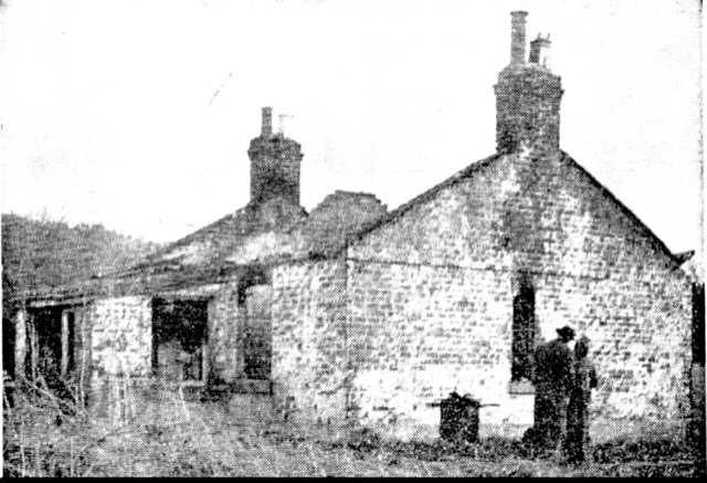
From old Ordnance Survey maps, as well as from memories of local residents, and from old newspapers, one can trace the history of the land that was to become Cubbin's Green. Before the railway was built in 1886, the area was fields used for grazing. The area to the North West - now where Wordsworth Walk and Shelley Way are - became a brickyard around 1890. This was very likely to have been connected with the building of the railway (from West Kirby to Hooton) which opened in 1886 and had brick-built bridges. Clay was extracted locally and ponds remained afterwards. The brickyard was disused by 1910, although a dwelling called Brickfield Cottage remained. This, image, was damaged by fire in 1959.
Another development was the management of sewage from Caldy. Sewage Tanks were built in a sunken area at the South East end of Cubbin's Green (at a date between 1910 and 1930). Presumably sewage was stored and then released through a pipeline into the sea at high tide. The sunken area still exists and the pipeline is still visible. Concrete steps down into the area are still in place. There is a manhole in the sunken area which sometimes releases waste water into the area after storms - so the area is often a lake, at times quite deep. The privet hedge that once surrounded this facility is still evident in places.
The 1950 map shows a building (approximately 6 metres by 8 metres) on the cliff edge (near the ramp that is now present). This building was a wartime pillbox, built as a coastal defence. It may also have been used as an observation post. The building had disappeared from the map by 1960, although a newspaper report in 1972 describes tidying up a former gun emplacement, precariously situated, on Caldy Cliffs. Some pieces of concrete can still be seen among the rock armour in the appropriate area.
Bridges: when the railway was built, in this area there were four bridges:
(i)track over Croft Drive (near Caldy Station) [track removed]
(ii)track over access to fields near Melloncroft Drive [wooden footbridge now]
(iii)track under a bridge (near where Wordsworth Walk is now) [completely removed]
(iv)track under Sandy Lane (near Kirby Park Station) [still in use]
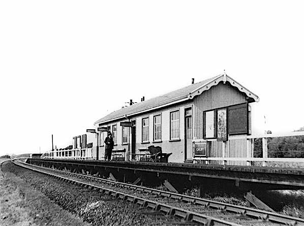
Image of Caldy railway station in 1953 (from here):
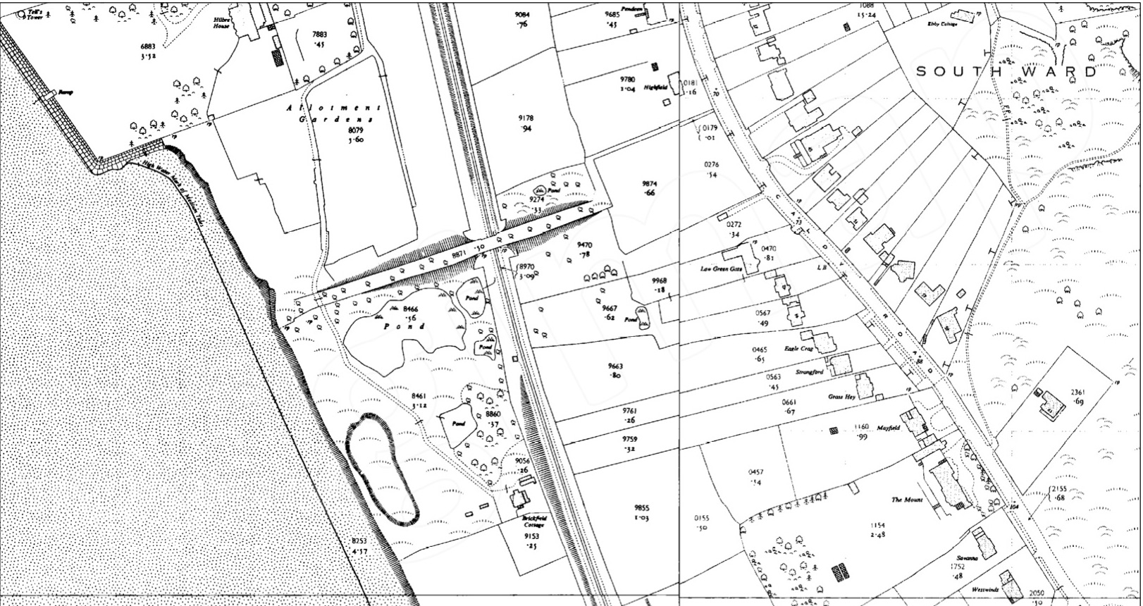
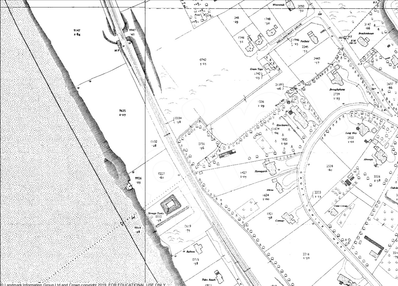
OS maps of the area in the 1950s that would become Cubbin's Green [at that date
only numbers 2,4,6 and Greentops were built in Melloncroft Drive].
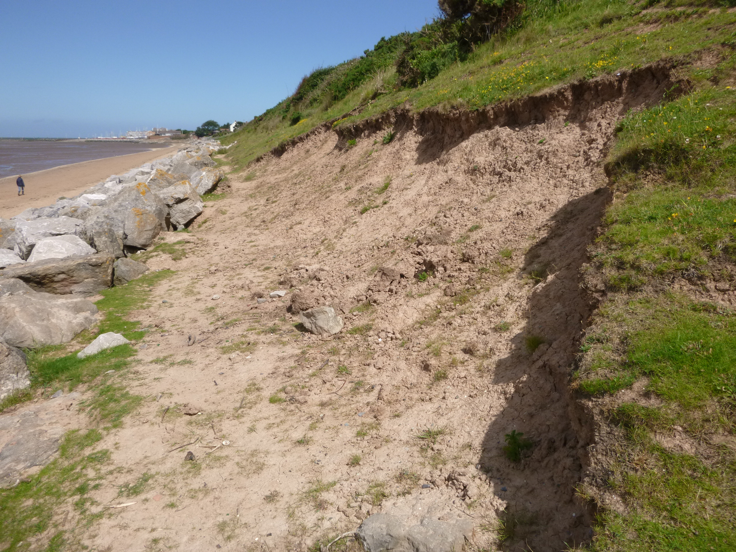
Sea defences. The clay cliffs on the seashore are liable to erosion from waves and from rain. From Thurstaston to Caldy, the policy is "let nature take its course" - which allows a variety of rare plants to grow on the newly exposed surfaces after erosion. From Caldy to West Kirby, the policy is "hold the line" and large rocks were placed along the base of the cliffs in the early 1990s. Earlier work (in 1978) had strengthened the base of the cliffs and improved the drainage at the top of the cliffs, so that erosion would be reduced [5 channels down the cliff filled with rocks are still in place]. The storm surge of December 2013 (wind-driven tide reached 11.1 m height above Chart Datum) caused damage to the cliffs at Cubbin's Green since the waves overtopped the existing rocks and eroded the clay cliffs behind. The rock armour was increased in height (bringing large rocks from North Wales quarries) as a result. The clay cliffs still erode - a combination of dry weather and heavy rain can break and then loosen the clay - causing minor land-slips.